
ACCESSIBILITY OBSERVATORY
Ana Puente, Naroa Coretti, Iñigo Azcárate, Giuseppe Foti
City Scope developers: Fabiana Belén Dávalos, Benjamín Suárez, Ane Pozo, Alejandro Sempere (Tecnun students)
As part of a broader initiative focused on decarbonization, social cohesion, and economic development, the City Science Lab Gipuzkoa (CSG) has launched a long-term strategic project called the "30-Minute Transit-Accessible Region”. This concept expands upon the well-known idea of the 15-minute walkable city, adapting it to a regional scale—such as Gipuzkoa—where the goal is for all residents to access essential daily services within a 30-minute public transit ride.
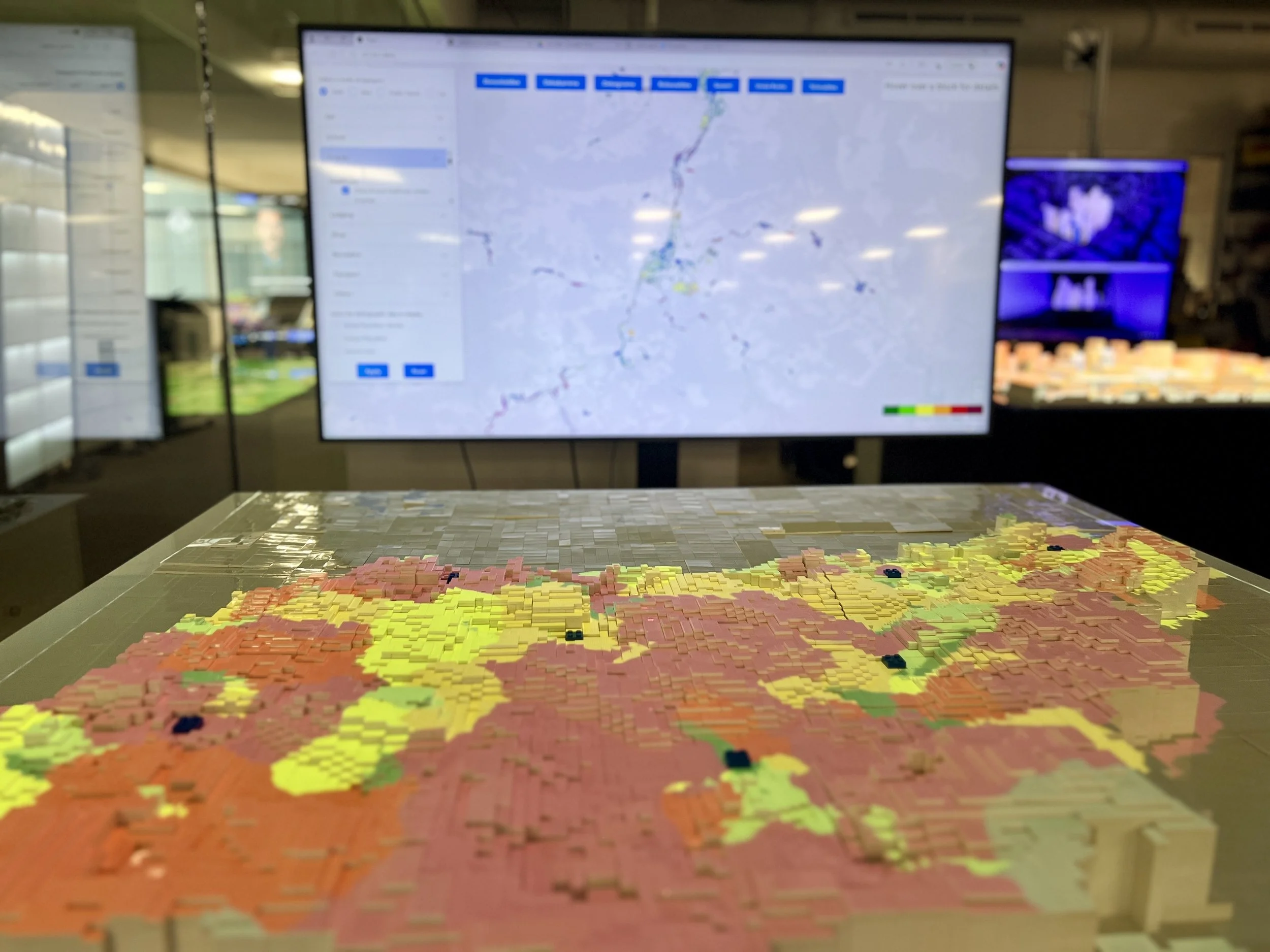
As a pilot initiative, the CSG, in collaboration with the MIT Media Lab, has developed the Accessibility City Scope, a data-driven observatory designed to analyze the accessibility of every building in Gipuzkoa. The tool assesses access to over 80 types of amenities and services across four modes of transportation, using real public data, including socio-demographic indicators.
200000 buildings
+80 amenity types
4 modes of transportation
64M calculations
By quantifying travel times from every building in Gipuzkoa to over 80 service types, the project provides a detailed understanding of real accessibility patterns across the region. This evidence-based approach allows for identifying disparities in access and understanding how these vary across different population groups and geographic areas.
PERSPECTIVE 1: HOW LONG DOES IT TAKE?
The tool is designed to support policymakers and planners by providing actionable insights. It helps identify priority areas for public investment, such as where to enhance public transportation, where vulnerable populations are most isolated, and where new services or infrastructure—like schools, clinics, or civic centers—should be established. It offers a data-informed foundation for promoting equitable access and improving spatial justice across the region.
The project has been brought to life through a physical, interactive platform, allowing stakeholders to engage directly with the data. This interface enables intuitive exploration of accessibility conditions, visualizing metrics for the whole Gipuzkoa. It serves not only as a technical tool but also as a collaborative decision-making space for public officials, urban designers, and citizens alike.
PERSPECTIVE 2: HOW FAR CAN I GO?
This second perspective offers an alternative view of accessibility. By providing isochronic maps, we illustrate the areas that can be reached within 5, 10, and 15 minutes using four different modes of transportation: private vehicle, public transit, bicycle, and walking. This approach helps identify underserved areas—locations where accessibility is limited or uneven across different transport modes—thereby supporting more equitable planning and resource allocation.
Link to the Accessibility City Scope
👉 Download data file